
Sources for South Milwaukee Neighbors
A block lookup combines geometry with dated public records. The South Milwaukee ArcGIS map supplies parcel shapes and address context. County land information adds imagery and service layers. MyVote supports an individual address match but does not publish a block roster. City election results provide ward totals, not voter names. Community groups and old directories add local context, subject to their own gaps.
| Source | What It Shows About a Block | Access |
|---|---|---|
| South Milwaukee ArcGIS | Adjacent parcel shapes, IDs, addresses, and map context | Public ArcGIS portal |
| City assessment data | Recorded owner, tax key, mailing context, and dated assessment details | Public city entry page |
| Milwaukee County MCLIO | County parcel context, imagery, applications, and downloadable layers | Public data hub |
| MyVote Wisconsin | An individual registration match at an address, not every person on the block | Individual search; bulk data follows a request process |
| Community organizations | Named civic groups, places, events, and public contacts | City inventory; no member roster stated |
| Directories and newspapers | Historical household, street, obituary, and event references | Library collections with gaps |
A parcel owner may live elsewhere. A mailing address may belong to an agent or other contact. A registered voter result is time-sensitive, and a directory lists only what its publisher gathered in that year. South Milwaukee neighbors should therefore be described with source labels such as recorded owner, registration match, historical listing, or geographic adjacency. Those labels prevent a nearby name from becoming an unsupported claim about the household.
South Milwaukee Neighbor Parcel Dates
The city parcel page dates assessment and ownership data to December 1, 2025, while map information is current to January 1, 2026. These dates are unusually useful. They show why a map screenshot and an ownership line may describe slightly different moments. Save both dates whenever nearby parcels are compared.
The manifest capture comes from the South Milwaukee Parcel Mapping and Assessment Data page, which launches the ArcGIS service.
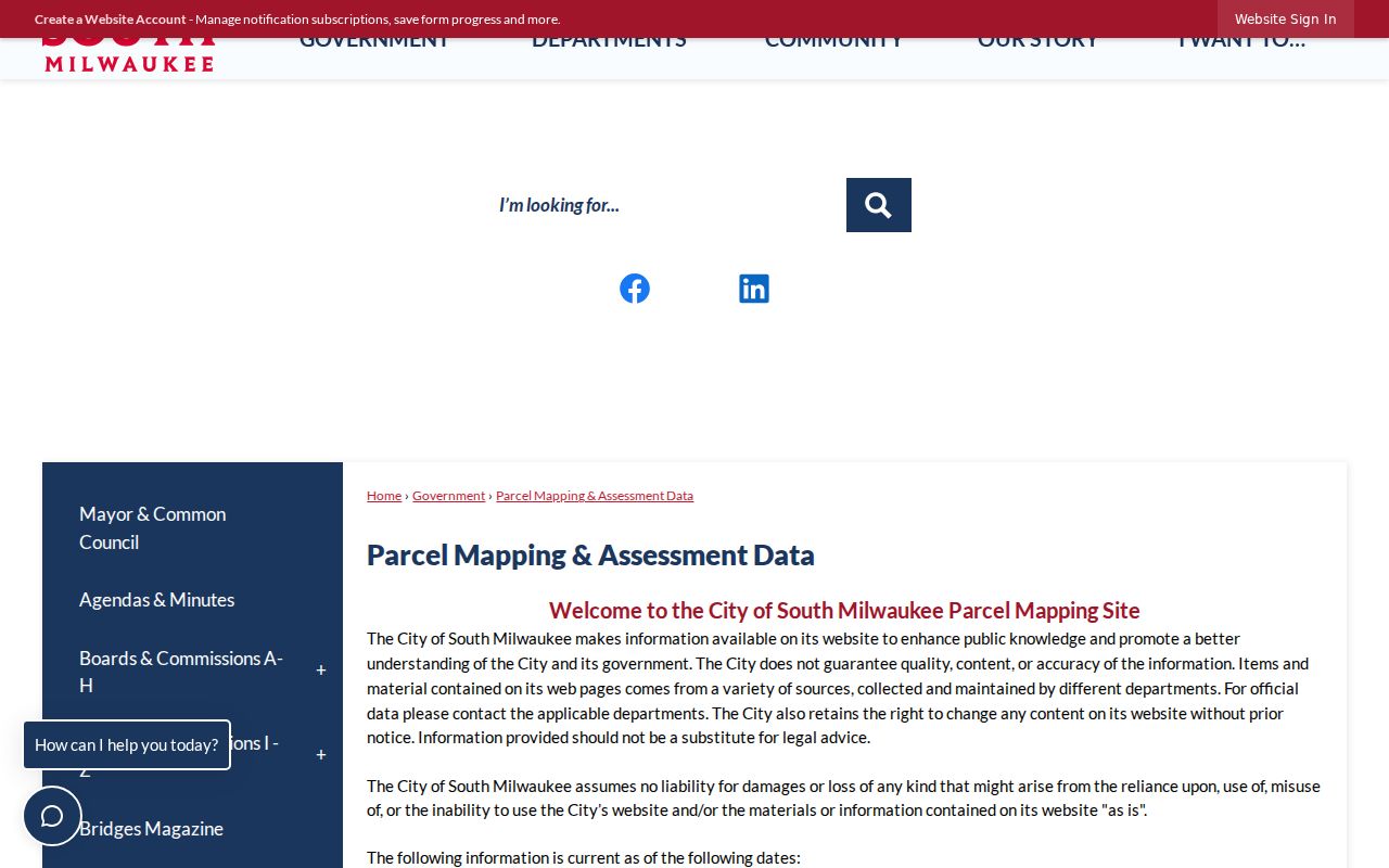
The visible city disclaimer gives each South Milwaukee block search a firm date instead of implying that parcel and ownership data updates at the same instant.
Map South Milwaukee Neighbor Parcels
Begin with one verified street address, then work outward only to parcels that touch it or sit across the same block face. ArcGIS supplies the spatial relationship. The assessment entry supplies the recorded property context. If the dynamic app does not expose an expected field, do not fill it from memory. Use the county hub or ask the city custodian for the needed record.
- Normalize the street number, suffix, direction, and unit. Open the South Milwaukee ArcGIS portal and find the subject parcel.
- Select each adjoining lot and record its parcel ID, address, geometry, and visible date. Include the parcels across the street only if the defined study area calls for them.
- Compare each parcel with the assessment record. Keep situs address, which is the property's location, separate from the owner's mailing address.
- Label the result as geographic adjacency or recorded ownership. Add a voter or directory source only when that separate check is lawful and useful.
The successful South Milwaukee ArcGIS portal capture shows the official gateway used for the parcel step.
Once the immediate block is mapped, a full named-road chain belongs in the South Milwaukee Street Directory.
Separate Owners From South Milwaukee Neighbors
Four fields can point in different directions: parcel location, recorded owner, tax mailing address, and current occupant. The parcel map proves where a lot lies. A deed records a legal interest. An assessment record reflects the city's dated tax and property data. None proves that the owner sleeps at that address or identifies every person in the home.
Keep a small source ledger for each nearby lot. Record the exact label, date, and URL. If a name comes from a deed, call that person a grantor or grantee, meaning the person transferring or receiving the recorded interest. If a name comes from a directory, call it a listing. This source discipline is especially important for duplexes, units, trusts, and parcels with an out-of-city mailing address.
Note: Geographic adjacency does not establish family, friendship, conflict, shared occupancy, or any other relationship between people.
South Milwaukee Neighbor Connections
The city's organization inventory names Friends of Grant Park, Growing South Milwaukee, Downtown Market, the South Milwaukee Historical Society, Human Concerns, Lions Club, Little League, and the South Milwaukee Performing Arts Center. These groups can provide public event dates, place names, programs, and contact routes. The city inventory does not advertise a complete member or household directory.
| Community source | Useful block context | Roster limit |
|---|---|---|
| Friends of Grant Park | Park events and Grant Park place references | No member directory shown |
| Growing South Milwaukee | Community projects and civic activity | No household roster located |
| Downtown Market | Dated market, vendor, and event records | An event link is not residence |
| Historical Society | Place history, museum, and research contact | No complete resident index |
| Lions Club and Little League | Civic and youth activities | Membership lists not located |
| Performing Arts Center | Dated programs and organization names | An audience list is not public |
The captured South Milwaukee Community Organizations page confirms the official inventory.
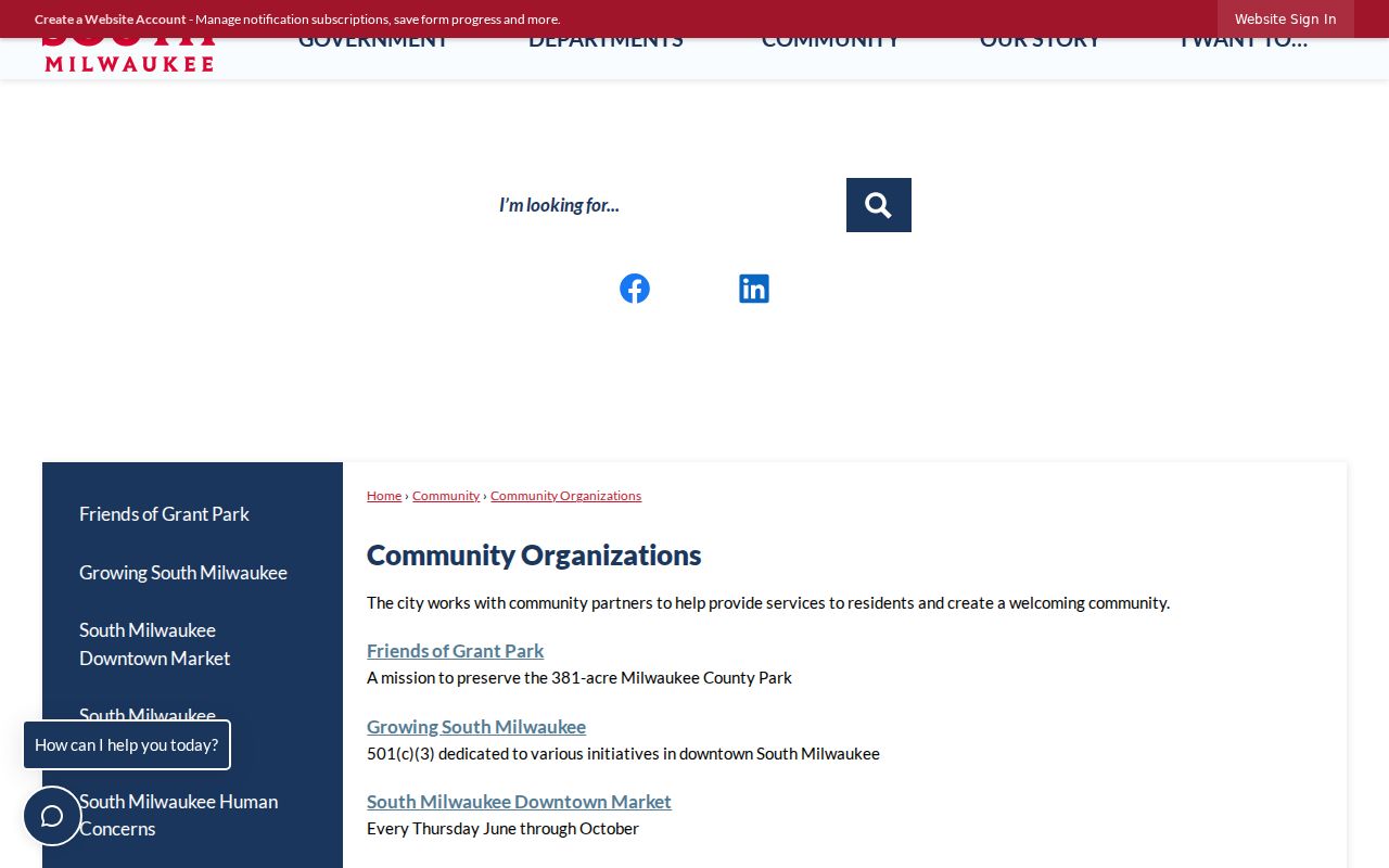
This source helps place civic activity on the block without turning public organization names into a list of private participants.
South Milwaukee Neighbor Watch
South Milwaukee reports several active block-watch groups that work with police, and officers attend meetings. The Crime Prevention Unit helps residents start a group. This is a civic contact channel, not a directory of participating homes. Meeting notices or releasable city records may document a dated program, but they should not be used to expose who joined.
Planning documents also use names such as Historic Grant Park, Historic Lakeview, Lakeview, Lakeshore, Parkway Heights, South Towne, M District, Drexel Highlands, and Blakewood. These names supply geographic context. They do not become official parcel boundaries unless the cited plan map defines them. Grant Park itself is about 381 acres, so a place label can cover far more ground than an immediate block.
South Milwaukee Neighbor Voting Lines
MyVote provides name and date-of-birth search or an individual address search with street, unit, city, and ZIP fields. It is not a browseable roll of everyone on a South Milwaukee block. Older participation and bulk files require a Badger Voters request, quote, payment, and download. Protected voters can be excluded or shown through substitute-address rules.
City election-result PDFs publish ward-by-ward totals for candidates. Those totals describe an election area, not the names of voters or their choices. A ward boundary can add civic geography to a neighbor search, but it does not establish occupancy. Keep the ward map's date because district lines and assignments can change.
Official South Milwaukee Block Records
Commercial neighbor tools often blend public and purchased data without making the source date clear. Official portals are narrower, but their labels and custodians make each claim easier to test. Use the category only as a lead, then confirm through the city, county, state, library, or records custodian.
| Source type | Strength | Main limit |
|---|---|---|
| Official parcel or assessment record | Dated parcel and ownership context | Owner is not necessarily occupant |
| Official voter tool | Individual registration match | Protected, stale, or absent records remain possible |
| Library directory | Dated historical street listing | Collection gaps and subscriber bias |
| Commercial compilation | Broad lead gathering | Unknown update cycles and merged identities |
Privacy for South Milwaukee Neighbors
Wisconsin Public Records Law carries a strong presumption of access, but it does not open every address or person record. Safe at Home under Wis. Stat. §165.68 provides a substitute address and mail forwarding for eligible people facing safety threats. Confidential electors may keep their actual address private under Wis. Stat. §66.0504(2). Vital records, DMV data, juvenile files, protected court matters, and active investigations have separate restrictions.
A missing address can be lawful protection. Never use a nearby mailing field, ZIP, directory entry, or map layer to defeat it. Retain only what the block question needs, such as parcel ID, source date, and a role label. If a city record is needed, a narrow request under Wis. Stat. §§19.31–19.39 should identify the address, record type, date range, custodian, and desired format.
Block research also has a time limit. South Milwaukee says its assessment and ownership snapshot was current on December 1, 2025, while map information was current on January 1, 2026. A sale, lot split, corrected owner name, or new mailing contact may post later in one system than another. Save both dates, then check the latest deed when a parcel change matters. Community-organization pages are even less exact: they show civic contacts and service areas, not a roster of people living nearby. Keeping the date and record purpose beside every name prevents a stale listing from becoming a claim about a current neighbor.
When the online map fails, use the same address at the city assessment counter or ask the Milwaukee County Land Information Office about its public layers. A tax key is the safest handoff between systems. Write down the parcel on each side of the subject lot rather than guessing from house-number order, since corner parcels and rear lot lines can make the nearest number a poor measure of legal adjacency.
Lawful use. Research South Milwaukee neighbors only for lawful personal, civic, historical, or safety purposes. Never watch, harass, intimidate, expose, or harm a person.