
South Milwaukee ZIP Coverage
Official city material commonly publishes 53172 for South Milwaukee. It is the one standard city ZIP confirmed in the reviewed sources. No official local source established a separate PO-box-only ZIP, unique institutional ZIP, boundary polygon, or historical split for the city. That gap should remain visible rather than being filled with a commercial boundary map.
| ZIP Code | Areas Covered | Post Office | Notes |
|---|---|---|---|
| 53172 | South Milwaukee mailing addresses | Verify through USPS | Commonly published city ZIP; not a legal city boundary |
South Milwaukee covers 4.83 square miles beside Lake Michigan, between Cudahy and Oak Creek. Planning names such as Historic Grant Park, Lakeview, Lakeshore, Parkway Heights, South Towne, the M District, Drexel Highlands, and Blakewood can sharpen a search inside 53172. They are planning descriptors, not separate postal towns or proof that a specific parcel belongs to a neighborhood.
Verify South Milwaukee Mailing Data
The USPS ZIP Code Lookup is the official place to normalize a current mailing address. It offers three useful paths: look up a ZIP by complete address, search by city and state, or list cities associated with a ZIP. Use the complete-address path when a house number, unit, or street suffix matters.
| USPS path | Input | Best use |
|---|---|---|
| By Address | Street, unit, city, state | Standardize one deliverable address and obtain its ZIP+4 |
| By City and State | City and Wisconsin | Check the standard ZIP associated with South Milwaukee |
| Cities by ZIP | ZIP code | See USPS city labels associated with that code |
The USPS lookup screen separates these postal questions before a resident search begins.
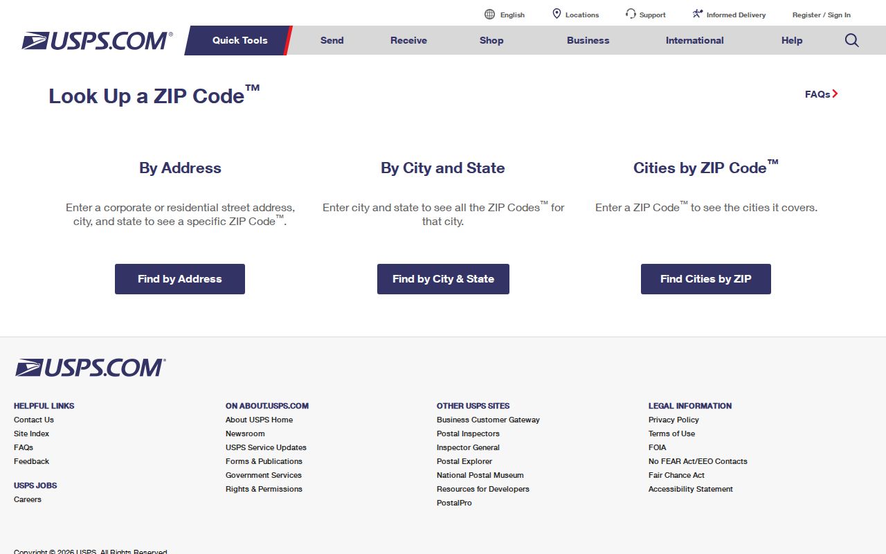
The source verifies delivery formatting. It does not show who lives there, parcel ownership, a ward, or whether a point falls inside the legal city line.
One South Milwaukee ZIP
A single commonly published ZIP makes the city easy to label but does not make every record searchable by ZIP. County land systems often work better with an exact site address or tax key. A tax key is the identifier attached to a parcel account. The South Milwaukee parcel page leads to the city ArcGIS portal, while Milwaukee County supplies property, tax, mapping, and deed context.
The city parcel notice is also date-sensitive. Assessment and ownership data were marked current through December 1, 2025, and map information through January 1, 2026. Keep those dates with any result. An owner name, tax mailing address, site address, and current occupant can all differ. The South Milwaukee parcel and assessment page is therefore an address check, not a ZIP-wide roster.
The city ArcGIS portal is a dynamic map. Its public text did not expose a dependable list of every live search field. At the service level, the system documents search text, searchable fields, layers, geometry, and related map parameters, but those technical controls should not be presented as the resident-facing form. Read the live labels, search the exact address, and record only the attributes the map displays. If the map fails, use the city parcel page as the official starting point and ask the responsible city department about the address or tax key.
Milwaukee County's property portal offers another address and tax context, but the county disclaimer matters. A property-tax record may name an owner or mailing recipient without proving who occupies the South Milwaukee address. The Register of Deeds records transfers and other instruments, which are also not a current resident list. ZIP geography narrows the place; the source type determines what can be claimed.
Note: Save the full street line and tax key; 53172 alone is too broad to distinguish one South Milwaukee parcel.
Search South Milwaukee by ZIP
The strongest ZIP code directory workflow starts with a verified address, then uses each public source for the narrow fact it holds. No official comprehensive list of every South Milwaukee resident was found. MyVote supports individual name and date-of-birth lookup or an address search, but it should not be treated as a list of all occupants.
- Enter the complete address in USPS lookup. Preserve the standardized street line, city label, ZIP, and ZIP+4.
- Open the city parcel portal and search the exact South Milwaukee site address. Capture the tax key and visible data date.
- Use MyVote Wisconsin for the official individual or address-based election lookup within its public purpose and access rules.
- For older participation or an authorized data request, use Badger Voters and follow its terms and fee process.
- Once the right street is known, use the South Milwaukee street directory process for parcel and deed work.
MyVote's name search uses First Name, Last Name, and Date of Birth. Its address path uses Street Address, Unit, City, and ZIP. A possible match can prompt the user to identify their own record. It does not create permission to collect or republish a block-wide resident list.
South Milwaukee ZIP Search Fields
Use the MyVote address fields as an individual official lookup, not as proof that all residents at the property appear. Unit formatting and dynamic field behavior can change, so read the live form before interpreting a failed match.
| Field | Input type | Use in 53172 | Limit |
|---|---|---|---|
| Street Address | Text | Enter the exact standardized street line | Not a roster of occupants |
| Unit | Text | Add when the USPS address includes one | Live required status not confirmed |
| City | Text | South Milwaukee | Mailing label is not a parcel boundary |
| ZIP | Text | 53172 | Broad geographic check only |
Older voting activity is not shown in the ordinary individual view beyond the portal's stated period. Badger Voters is the state route for older participation and list requests. Public scope remains subject to protected-voter and statutory exceptions.
A missing address can reflect lawful protection rather than an error. Wisconsin Safe at Home provides a substitute-address program, and confidential-elector rules can restrict address disclosure. Court, vital, and motor-vehicle records have their own limits as well. Do not use a ZIP search to infer that a protected person left South Milwaukee or never lived there.
South Milwaukee Before ZIP Codes
ZIP codes began long after South Milwaukee's early records. City history places the 1891 layout in the Town of Oak Creek, village incorporation in 1892, and city incorporation in 1897. Older deeds may rely on legal descriptions, plats, lots, blocks, or township and range. Directories may use the street and the jurisdiction current in the publication year.
The library holds South Milwaukee city and telephone directories from 1911 through 1980, with gaps. Newspapers cover 1893 and 1899 through 2006, also with gaps. Search those sources by surname, initials, street, and year rather than adding 53172 to a record made before postal ZIP codes existed.
Milwaukee city's 1930 address conversion should not be imposed on South Milwaukee. No official universal South Milwaukee renumbering table was located. When an old street line fails, compare plats, ordinances, directory pages, newspapers, and the city's 1955 official map.
The county deed index can bridge an old legal description to later parcel records. Older instruments may be found through book and page, document number, plat, lot and block, or township and range rather than a ZIP. Keep the directory year and deed recording date separate. Each describes a different event, and neither should be rewritten to fit today's postal geography.
South Milwaukee ZIP Versus Limits
A ZIP describes mail delivery, while a city limit is a legal municipal boundary. The reviewed sources did not provide an official polygon proving that 53172 matches South Milwaukee line for line. Keep four fields when sources conflict: the raw ZIP printed in the record, the USPS-normalized ZIP, the municipal label, and the parcel municipality. Explain the difference instead of overwriting one with another.
- ZIP and ZIP+4
- A ZIP is a five-digit delivery area. ZIP+4 adds a more precise delivery segment for an address or group of addresses.
- PO-box ZIP
- A code used chiefly for post-office boxes. No separate South Milwaukee example was confirmed in the research.
- Unique ZIP
- A code assigned to one high-volume organization. No unique South Milwaukee code was confirmed.
- Carrier route
- A postal delivery route within a ZIP. It is not the same as a ward, neighborhood, parcel, or city limit.
Grant Park and Lake Michigan are useful geographic anchors, while Cudahy and Oak Creek frame the city's north and south. Planning districts and corridors can guide old newspaper or map searches, but each parcel still needs an exact municipal and tax-record check.
No South Milwaukee ZIP Split
No official current source in the research documented a South Milwaukee ZIP split, realignment date, or local boundary crosswalk. That is a source limit, not evidence that postal geography never changed. Verify a modern address through USPS and preserve the older ZIP exactly as printed when working from a historical item.
For parcel questions, the city map and county land records control their own fields. For election questions, MyVote and the municipal clerk control theirs. For a mail question, USPS is the right custodian. Keeping those roles separate prevents a postal label from becoming a false claim about residence, ownership, voting status, or city jurisdiction.